
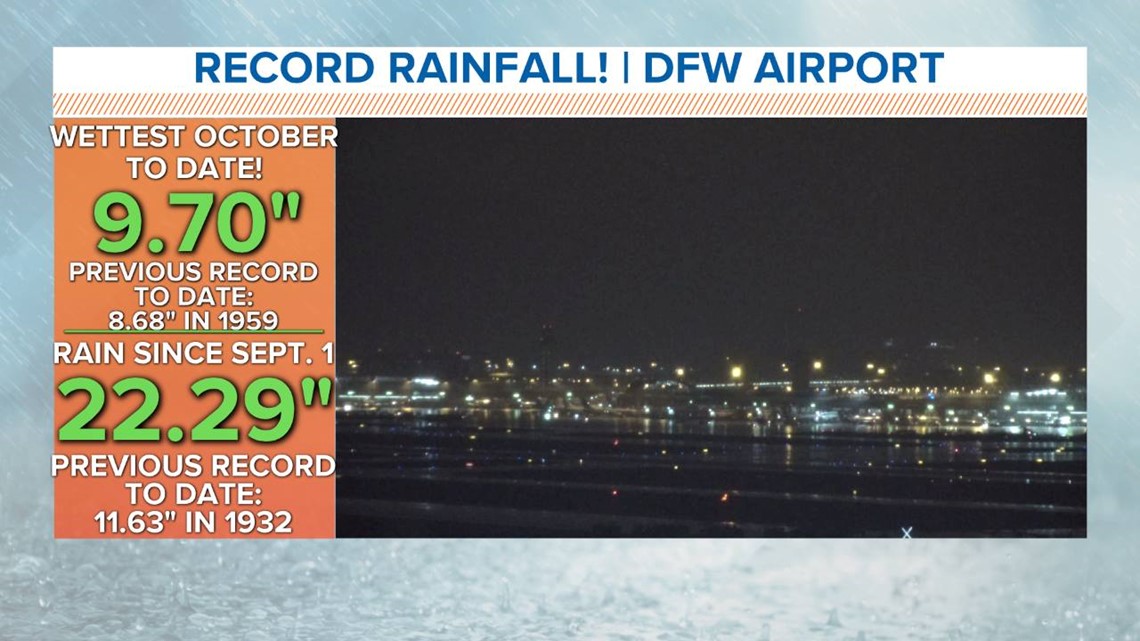
Who hit the fast forward button on the seasons? It was a rare and unusual October day. We hadn't set a record like this with highs in the 40s since records began in 1898!

More rain
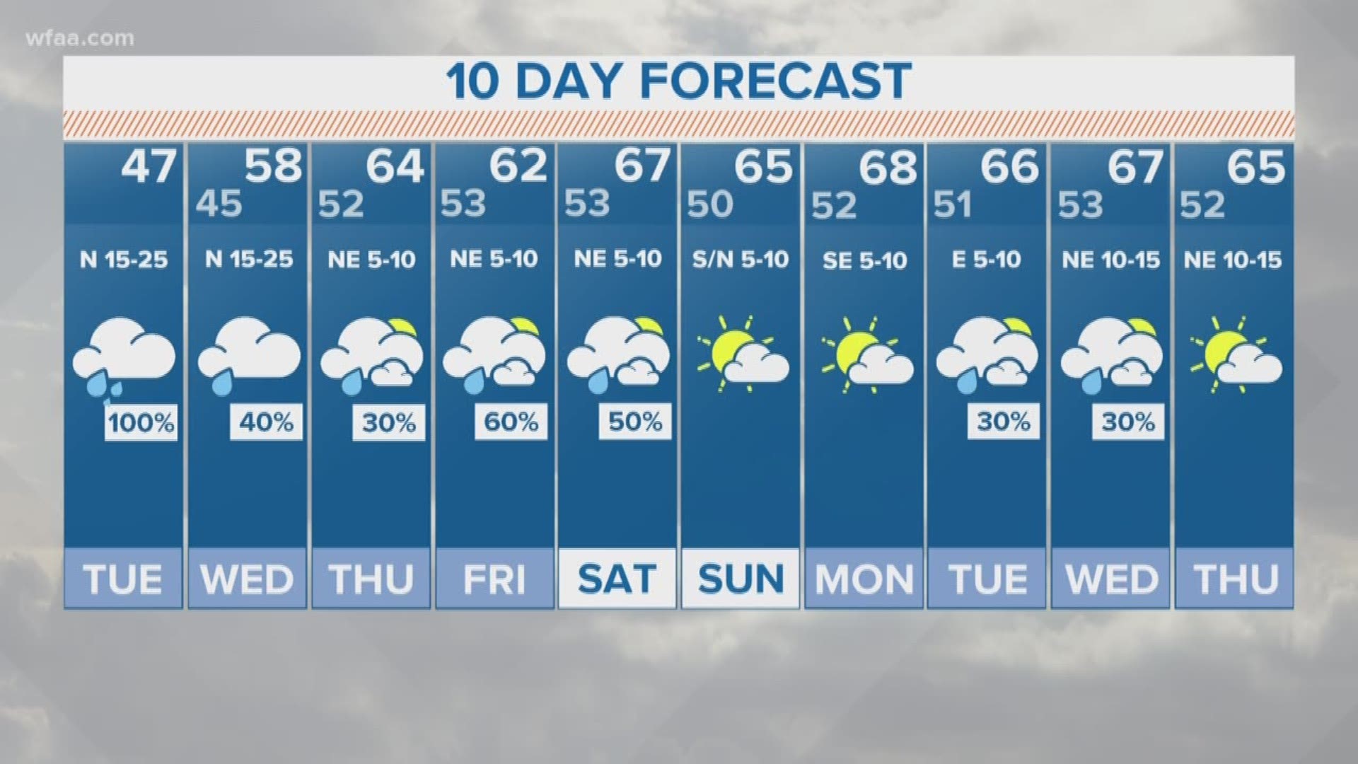
Is it over yet? Nope, more steady and cold rain overnight into Tuesday. We could pick up an additional 2 to 4 inches of rain. The Flood Watch has been extended until 7 p.m. Tuesday. Those additional rounds of rain will keep localized flooding a concern. Widespread rain totals over the next few days of 3 inches to 6 inches are possible by Wednesday morning.
Check Weather Alerts here
LATEST Traffic Map and conditions
Since this will come in rounds, and not all at once, the flooding threat may not be as significant. However, since it has been so wet recently, that rain will run off into creeks, streams, and rivers. Flooding threat may be centered around swollen rivers and creeks over the next few days. If you live in or around flood-prone locations, pay attention to the weather over the next few days!
Bottom line
It will turn downright cold in North Texas over the next few days. With clouds, rounds of rain, breezy winds, and chilly temps, Tuesday will be not so pleasant. You've been warned so find the cold weather gear and carry an umbrella!