
DALLAS — 6:30 p.m Update:
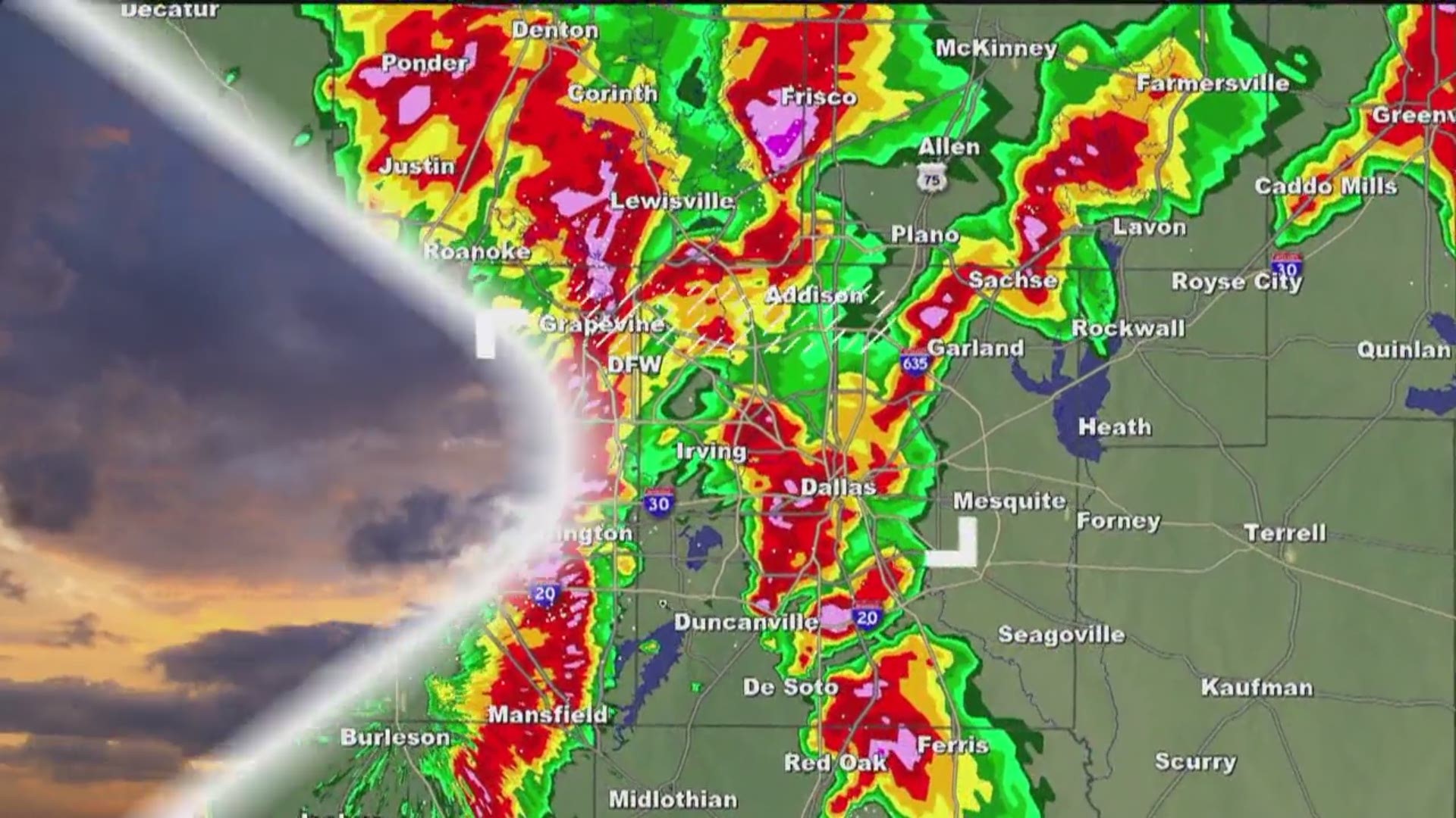
Scattered showers and storms have developed in parts of North Texas along an approaching cold front.
MORE: Check the radars
Not everyone will see rain through the remainder of the evening, but rain will continue to be out there.
Highest coverage looks to be across northeastern North Texas (Bonham to
Paris to Sulphur Springs) with scattered activity elsewhere.
DFW area could see a stray shower or storm through 10 p.m., but certainly not everyone will see rain.
Stronger storms could have some gusty winds and hail, but overall severe threat remains low through the evening into tonight.
RELATED: Daily forecast from WFAA
After the cold front passes, winds will shift to out of the north, and cooler air will move into North Texas.
By Monday, morning temps will be in the 50s with northern areas even in the 40s. Sunshine will return tomorrow afternoon, and highs will be in the low 70s. Back to pleasant fall weather!
Want to know when severe weather is headed for your area? WFAA has a new app. Download it here and sign up for severe weather alerts to stay informed.