Updated 5:30 pm. Tuesday with the latest forecast.
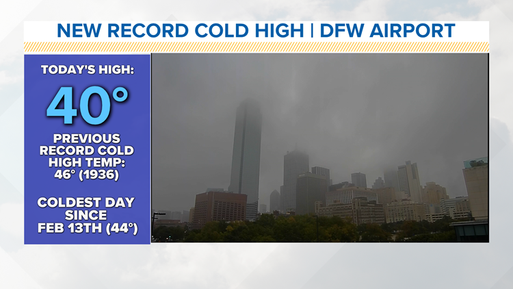
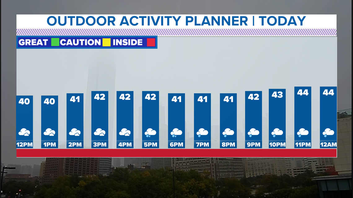
Cloud cover will keep temperatures around the 40-degree mark for the Dallas-Fort Worth area most of the day.
It will slowly start to warm up overnight into Wednesday morning. The coldest high temperature for Oct. 27 on record was 46 degrees set back in 1936.


RELATED: Check the radar for your area
On and off showers will be possible through Wednesday, making for a chilly and wet few days here in North Texas.
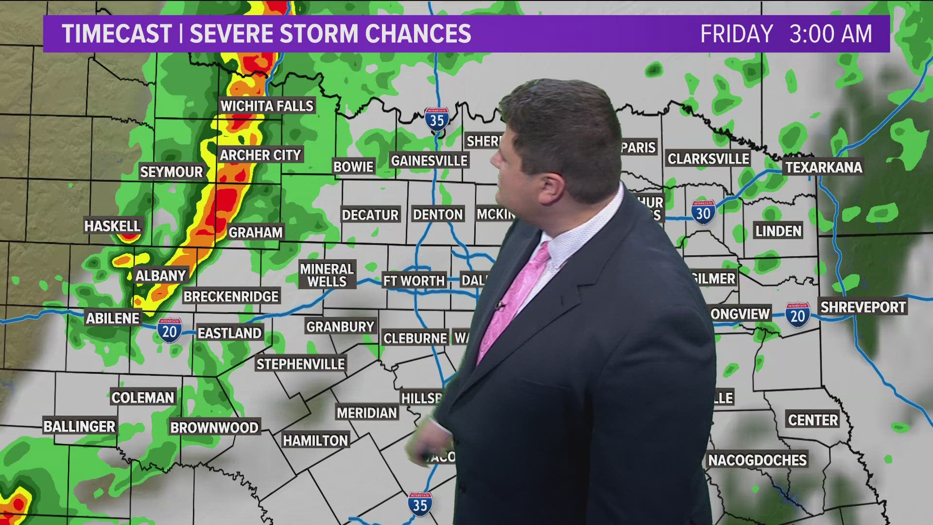
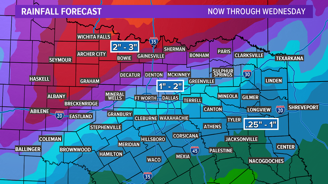
Rain chances
It doesn't look like it will rain constantly for three days straight, but on and off showers are likely through Wednesday.
The highest rain totals are expected across western and northern North Texas where 2 to 3 inches of rain is possible. Totals decrease for the Dallas-Fort Worth area and even less for eastern and southern North Texas.

But most of North Texas should pick up some beneficial rain since things have been a little dry recently.
Wintry weather!?
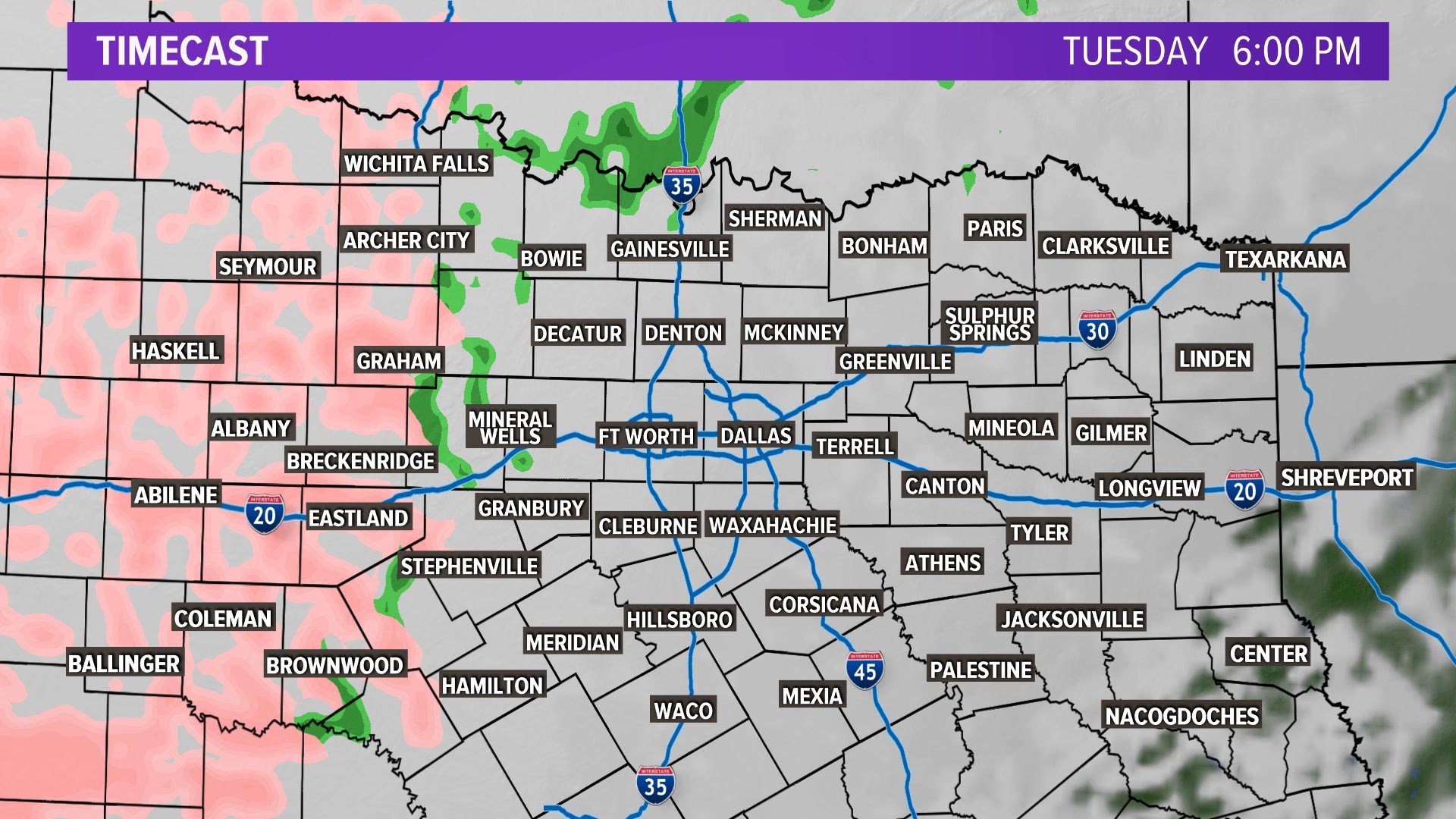
Most of North Texas will just see a cold rain this week.
However, temperatures have dropped below freezing in far western and northwestern North Texas, so a light bout of freezing rain has developed.
Significant icing is not likely, but there could be enough that could slow you down out on the roads.
There also could be some light icing on elevated surfaces such as bridges, overpasses, cars and trees.
Higher ice amounts are possible across West Texas into the Panhandle, as well as some actual snow.
A Winter Weather Advisory has been posted for western portions of North Texas as well: Young, Jack, Stephens, Palo Pinto and Eastland counties are included. Slippery travel from light freezing rain is possible into Tuesday morning. Some ice accumulation is possible on bridges, overpasses and other elevated surfaces.